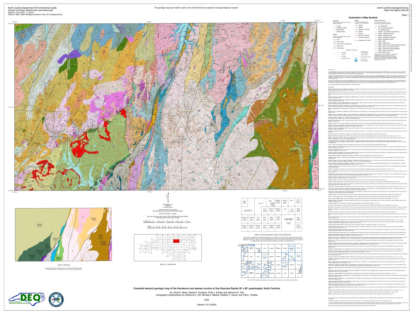
The geologic map for the Henderson 100k quadrangle has been created as a general-purpose map that is applicable to land-related investigations in the earth, environmental and biological sciences. Includes an index to terranes, a list of schematic distribution of terranes and map units, and rock unit descriptions. By David E. Blake, Edward F. Stoddard, Philp J. Bradley and Katherine E. Pelt. 2025. Approximate scale - 1:100,000. 2 plates - approximate size of Plate 1 is 42" x 55" and approximate size of Plate 2 is 42" x 50".
|