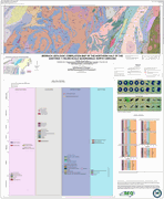

The geologic map for the Gastonia 1:100,000-scale quadrangle has been created as a general-purpose map that is applicable to land-related investigations in the earth, environmental and biological sciences. Includes correlation of map units, foliation data, fracture data and detrital zircon data. By B.L. Cattanach, B.T. Trantham, T.J. Douglas, A.S. Lynn, S.C. Bast and J.S. Hill. Geochronology by A.C. Curry and J.D. Quick. Approximate size - 46"x38". Approximate scale - 1:100,000. 2026.
|


